Rupprechtstraße: Unterschied zwischen den Versionen
Aus KoelnWiki
(Die Seite wurde neu angelegt: „{{Infobox Straße | lat = 50.921078 | lon = 6.923545 | z = 16 | bild = Rupprechtstr.pg | plz1 = 50937 | plz2 = | plz3…“) |
|||
| Zeile 3: | Zeile 3: | ||
| lon = 6.923545 | | lon = 6.923545 | ||
| z = 16 | | z = 16 | ||
| − | | bild = Rupprechtstr. | + | | bild = Rupprechtstr.jpg |
| plz1 = 50937 | | plz1 = 50937 | ||
| plz2 = | | plz2 = | ||
Aktuelle Version vom 18. Februar 2020, 18:20 Uhr
| Bild | ||
|---|---|---|

| ||
| Lage | ||
| ||
| Informationen | ||
| Straßennummer: | 2740 | |
| PLZ: | 50937 | |
| Stadtteil: | Sülz | |
| von: | Gustavstraße | |
| bis: | Marsiliusstraße | |
| Länge: | 132 m | |
| Stand | ||
| 18.02.2020 | ||
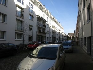
Die Rupprechtstraße liegt im Stadtteil Sülz.
In Nr. 5 steht im Hinterhof ein umgebauter Hochbunker aus dem Zweiten Weltkrieg.
| |